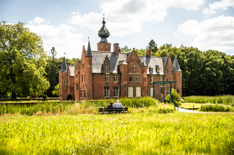
The Sterrebos Provincial Domain, located in Rumbeke in West Flanders, is a 27-hectare castle estate. Despite its location next to a busy highway, Sterrebos is an oasis of tranquility where walkers can leave urbanization far behind them.
Sterrebos Castle Estate
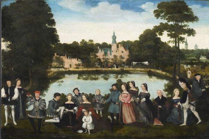
The origins of the castle estate date back to the second half of the 15th century. The castle as we know it today is largely the result of a construction campaign carried out during the 16th century by the lord of the castle, Thomas de Thiennes. The castle in its current form is depicted for the first time in a painting from 1535. At that time, however, the Sterrebos did not yet exist.
The construction of the star
The economic crisis that hit the late Middle Ages gave way to a new spirit from the 16th century onwards. With the Italian Renaissance as the ultimate example, art, literature, luxury, and personal development became central themes in our society too. 'Seize the day' became the motto of the beau monde, and relaxation was the norm.
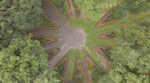
Hunting also became a particularly popular pastime for noblemen. Enter the 'star', laid out in the 18th century by architects H. Pulinckx and F. Simoneau. After all, such a star-shaped system of paths in a forest was the ultimate dream of the hunter, who always had to be able to approach the game against the wind. By dividing a forest into segments (triangles) that corresponded to the wind directions, like a wind rose, the hunter always had the advantage.
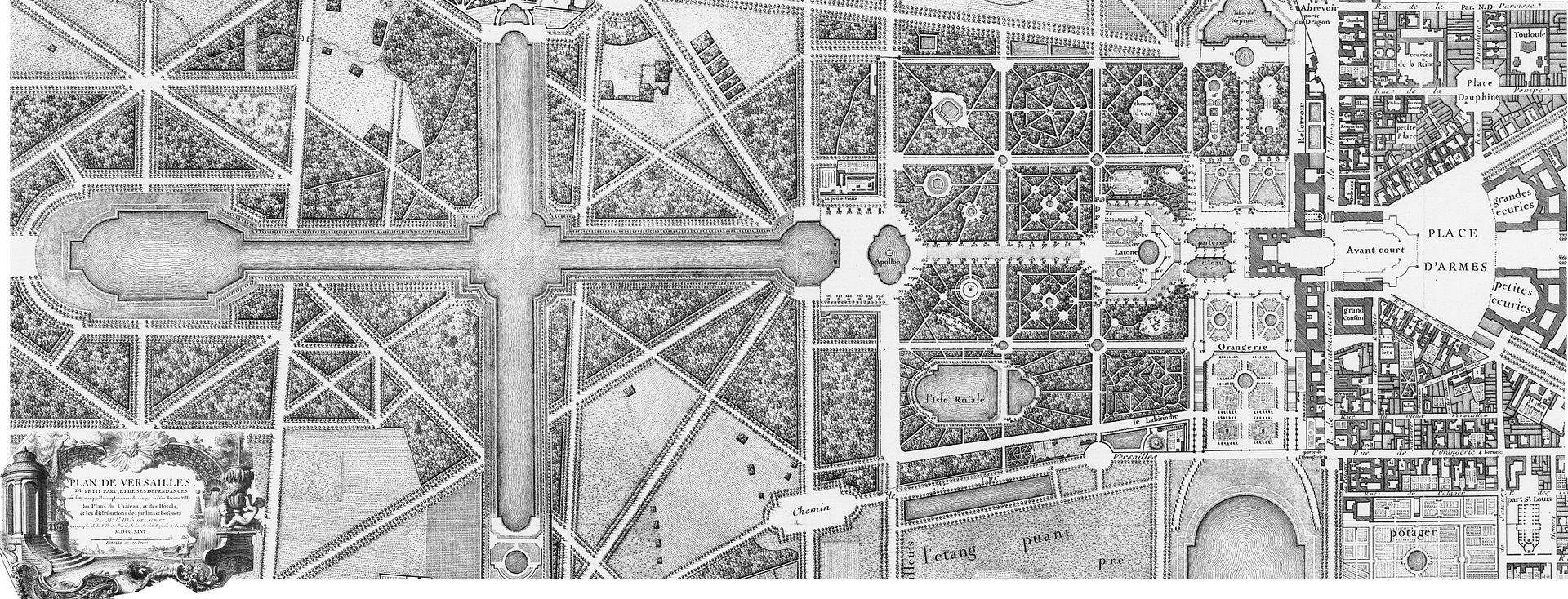
The star-shaped avenues in Rumbeke were laid out several centuries after the castle was built. In addition to their obvious purpose—hunting—this is a second explanation for why the paths do not start from the castle as their center. In several other Baroque parks, the castle is usually the center of the estate. A striking example of this is the Palace of Versailles, where the paths in the park start from the palace in a goosefoot pattern.
The Sterrebos clearly lives up to its name. The client for the redevelopment of the castle park was most likely General Joseph de Murray, commander-in-chief of the Austrian army, who married the widow of Charles Louis Albert de Thiennes. A star-shaped layout, consisting of a junction of yew hedges and brown beech hedges, has formed the basis of the castle grounds since 1769-1775. Twelve avenues radiate out from a central point in the shape of a star. Prior to the new landscaping, some preparatory work is carried out. The old farmyard to the west of the castle was demolished and the small pond to the south of the castle was filled in. The design by architects Simoneau and Pulinckx is said to have been inspired by the Prater in Vienna.
In the 1960s, all the avenues were conveniently named after the hours of the clock. Today, the star-shaped layout, together with Rumbeek Castle, is still an eye-catcher for every visitor to the provincial domain. Landmarks can be seen at the end of each avenue. A few examples:
The II-urendreef overlooks the church of Rumbeke.
The IV-urendreef overlooks the castle's old vegetable garden and quadrangular ponds.
The V-urendreef overlooks the stepped gable at the rear of the castle.
The VIII-urendreef overlooks the Bergmolen.
The XII-urendreef overlooks St. Michael's Church in Roeselare.
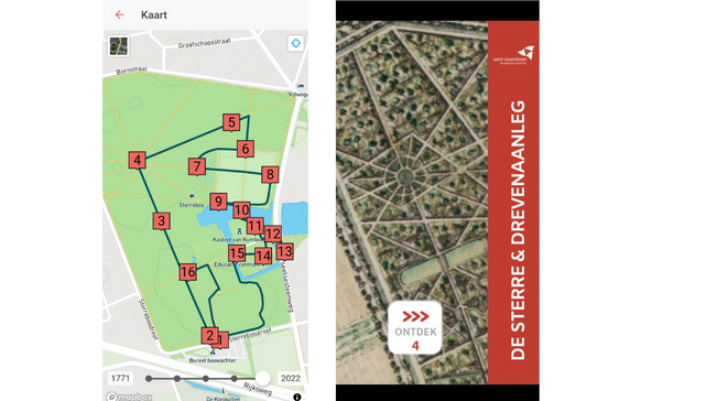
Want to find out more? Discover the 'star' in person with the ErfgoedApp.
You can also discover the other heritage walks in the Province of West Flanders via erfgoedapp